
Fous
ストックにはログインが必要です
Visual location intelligence for photos
Artificial Intelligence
Photography
Maps
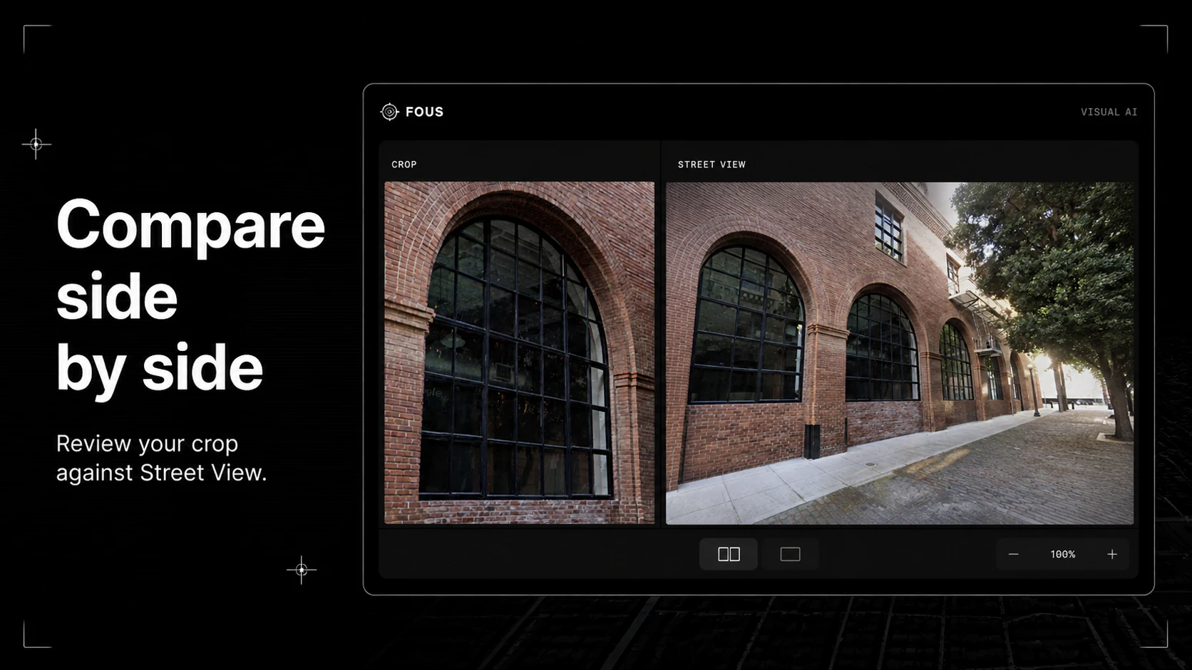
Fous turns photos into location context. Upload an image and Fous estimates where it was taken by analyzing visible scene details, without relying on EXIF, GPS, or embedded metadata. The first preview focuses on San Francisco, with confidence-scored results, map review, and a workflow built for verification, research, investigations, trust and safety, and personal photo archives.
投票数: 12